Highlighting three freshwater aquatic indicators co-developed with SARP
In February, I shared a blog with some background information on the Southeast Aquatic Resources Partnership (SARP) and how SARP and SECAS work together. I mentioned that we collaborate on some indicators that go into the Blueprint. This month, let’s dive deeper into three freshwater indicators that we co-develop with SARP’s Connectivity Program and their Barrier Prioritization Tool.
When it comes to identifying important places to conserve, protect, or restore for freshwater ecosystem systems, we hear a lot about riparian buffers, habitat fragmentation (specifically, longitudinal connectivity within river channels), and imperiled species. Yes, there are other important factors, too, like natural flow regimes, water quality, and lateral connectivity between the river channel and its floodplain. But when it came time to develop a consistent approach for the 2022 Blueprint, we knew we could start with recommendations and ideas for data from SARP related to those three factors and see where it took us. To learn more about the iterative cycle of testing and revision that we use to guide improvements to the Blueprint, check out Hilary’s blog on the Lean Startup method.
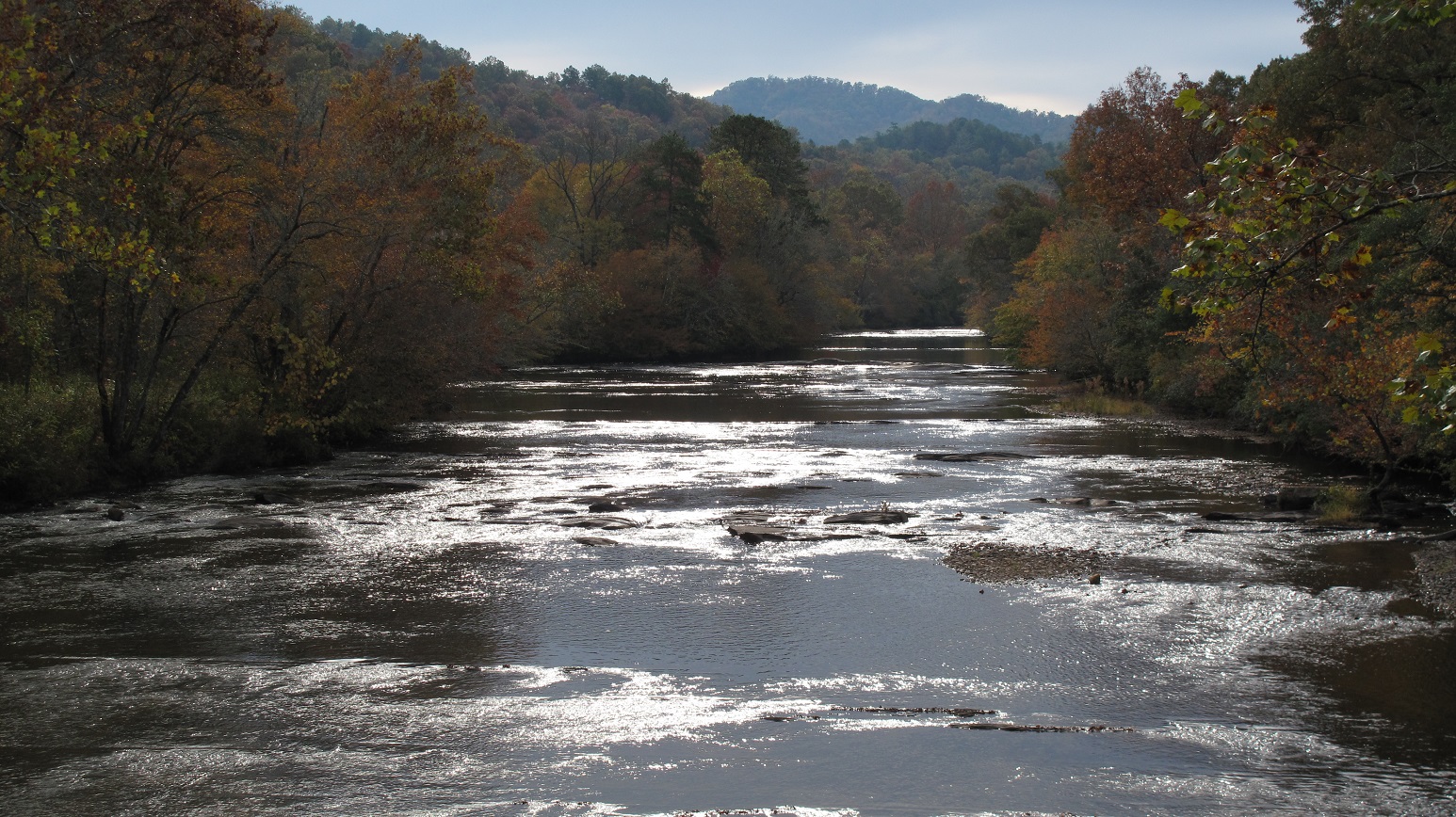
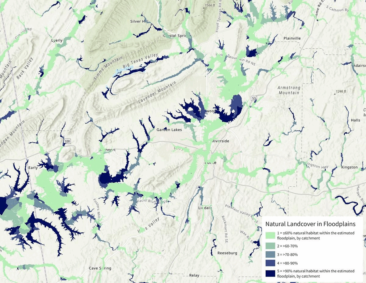
The natural landcover in floodplains indicator is based on the idea that floodplains—river channels and the adjacent areas of land known as “riparian areas” that periodically flood—are critical ecosystems that provide a wide range of services. Floodplains support a unique and diverse array of habitats for plant and animal species, help to reduce the impacts of floods, and improve water quality. The natural landcover in floodplains indicator measures the percent of the floodplain that’s composed of natural vegetation like forests, wetlands, and grasslands, rather than developed or agricultural land. It then averages the percent of natural landcover across all the floodplains within a particular catchment. This indicator helps to ensure the Blueprint prioritizes the “best of the best” floodplain areas, while also capturing some opportunities to restore natural riparian habitat that would produce co-benefits for other resources.
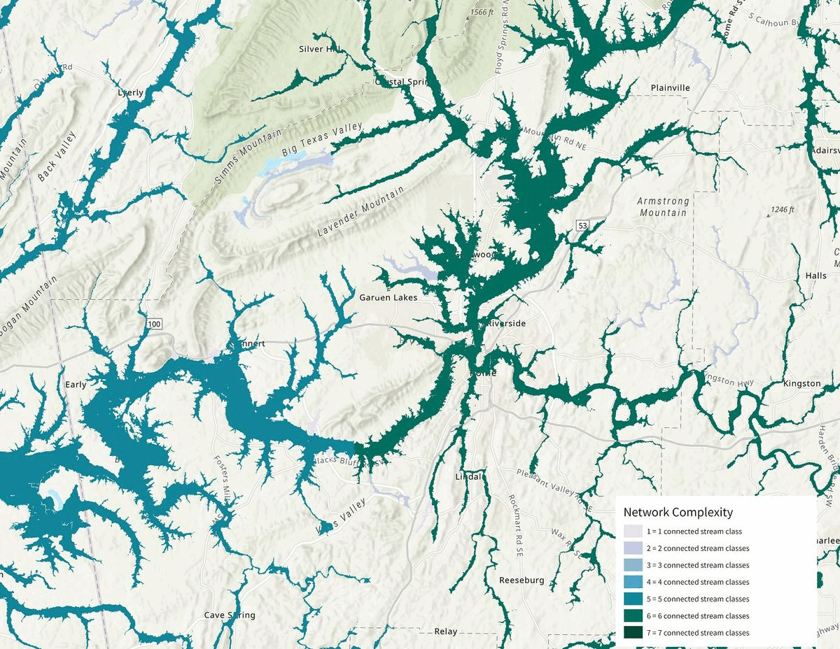
The network complexity indicator is based on the idea that the ecological significance of freshwater networks is closely tied to how connected they are to a diversity of instream habitats and river sizes. Areas that are highly connected to different river size classes help ensure the long-term health of ecosystems and support a greater diversity of species, particularly in the face of climate change as species move to find suitable habitat niches and access climate refugia. Like the previous indicator, network complexity applies to the floodplain, measuring the number of different size classes that each river or stream is connected to. By prioritizing highly connected aquatic areas, the Blueprint is helping the conservation community maintain and improve the condition of freshwater systems for the species that depend on them.
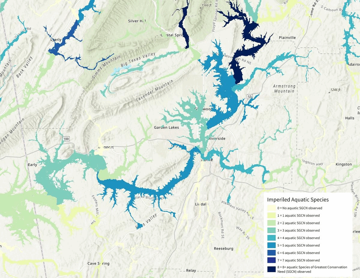
The imperiled aquatic species indicator identifies places where conservation action would benefit rare species like fish, mussels, snails, crayfish, and amphibians. It also applies to the floodplain, measuring the number of aquatic animal species identified as Species of Greatest Conservation Need that have been observed within the surrounding 12-digit HUC, or subwatershed. SARP does the hard work of compiling this data from Natural Heritage Programs across the region. The more species that are found with in a subwatershed, the higher priority it becomes in the Blueprint. In other words, these places could be intact, high-quality quality habitat for species that need to be enhanced or maintained, or they could be the last refuges for an imperiled species and it needs to be restored. By prioritizing these areas in the Blueprint, we are helping to ensure that they are protected, managed, and restored for the rare aquatic species that inhabit them.
That’s three different indicators that we use to identify important places for freshwater ecosystems in the Blueprint. Other freshwater indicators, like permeable surface, Gulf migratory fish connectivity and Atlantic migratory fish habitat have been influenced by SARP, too, but for the sake of time, I’m just covering three.
Shout-out to Kat Hoenke with SARP and the multitude of partners engaged with SARP who shared data and provided their expertise over the years to get us to this point! We are lucky to have a great community of aquatic expertise in the Southeast who are willing to “think big” and share resources across administrative boundaries.
Did we find all of your important freshwater habitats in the 2022 Blueprint? What are we missing? Send me your thoughts at emily_granstaff@fws.gov! Hopefully we can incorporate them into the next version of the Blueprint.