Future "collabs” between SARP and SECAS
Over the last several months, I’ve talked about the Southeast Aquatic Resources Partnership (SARP) and how we work together to develop some of the freshwater aquatic indicators in the Southeast Conservation Blueprint. The collaborations continue to grow as we exchange ideas, align resources, and promote adaptive management.
We have a couple of known issues with the freshwater aquatic indicators and SARP is working with states and other data providers to solve them. The imperiled aquatic species indicator and the network complexity indicator lack data for West Virginia, Puerto Rico, and the U.S. Virgin Islands. Until recently, those three geographies weren’t formally members of SARP, so they weren’t included in SARP’s data compilation efforts. Now, they have signed on with SARP and are sharing resources with SARP and SECAS to improve the Blueprint and SARP’s Aquatic Barrier Prioritization Tool–a great example of aligning resources to improve two decision support tools. We hope to have these updates ready for the 2024 Blueprint update cycle.
We’ve also begun conversations to explore how the SECAS Goal Report can inform an update to SARP’s Southeast Aquatic Habitat Plan. There are some early discussions of including trends in riparian health conditions as an indicator of freshwater ecosystem health to the SECAS Goal Report. Yet another way we that can work together to align processes and use our respective networks to be more efficient!
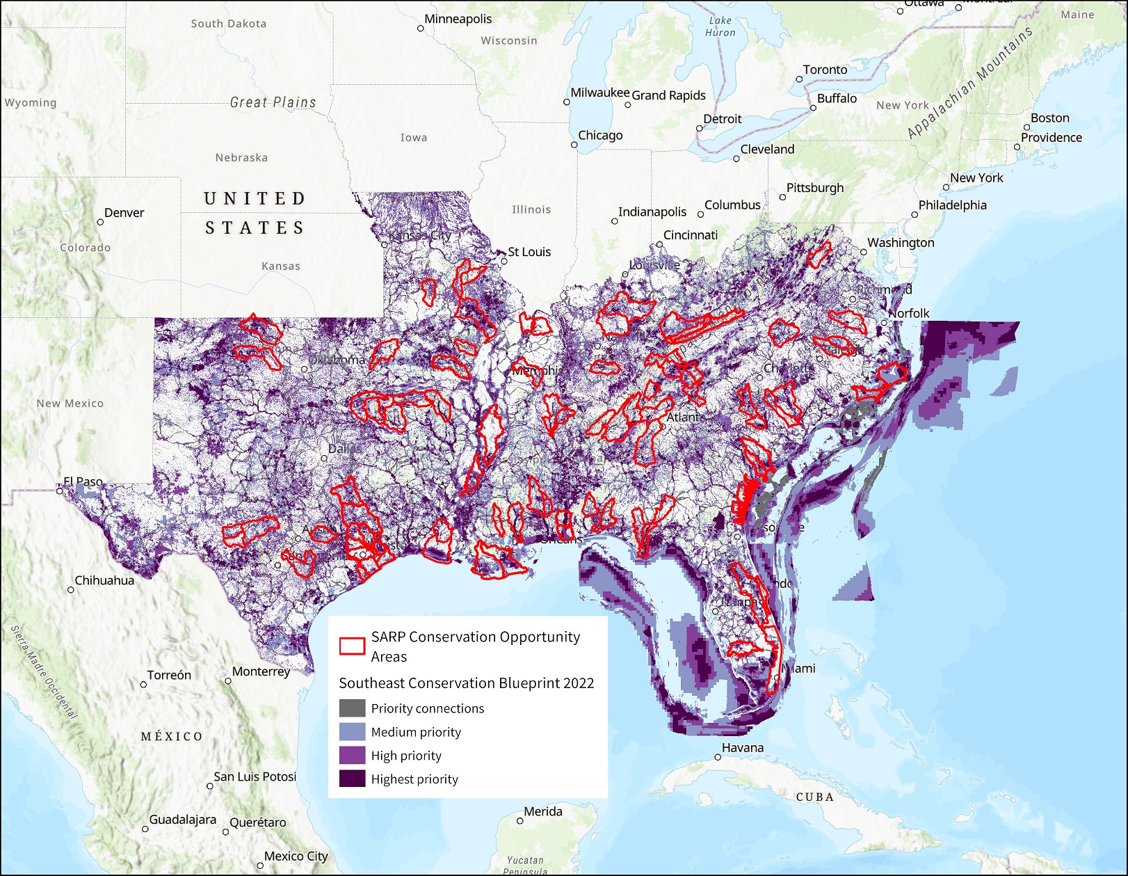
With ongoing discussions of how to improve the Blueprint and the SECAS Goal report, the SARP Steering Committee recently chose to “adopt” the Blueprint as their landscape conservation design that represents their priority areas. The regular updates to the Blueprint and Goal Report, consistent modeling approaches across the SARP geography, the ongoing integration of aquatic datasets into both products, and finer resolution of priority areas appealed to SARP’s Steering Committee members. The SARP Steering Committee and work groups will use the Blueprint and Goal Report in future decisions about where to implement actions and allocate resources on the ground, as well as monitor aquatic ecosystem trends to support collective discussions about adaptive management.
If you made it to this point of the blog post, I’m sure I’m preaching to the choir when I say that, if we want to tackle the conservation challenges of today, we have to do it together. I think SARP and SECAS have formed a strong foundation of trust that can spark new ideas for building a bigger connected network of lands and waters.
Are you working with a landscape partnership and want to learn more about SARP or SECAS for your work? To borrow language from the social media influencers, “let’s collab!”