Southeast Conservation Blueprint 2023 now available
The latest update to the Southeast Conservation Blueprint, version 2023, is now available!
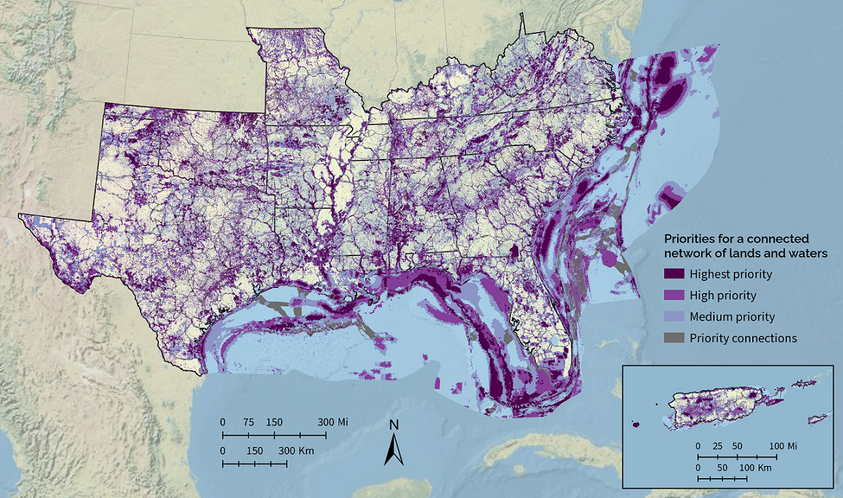
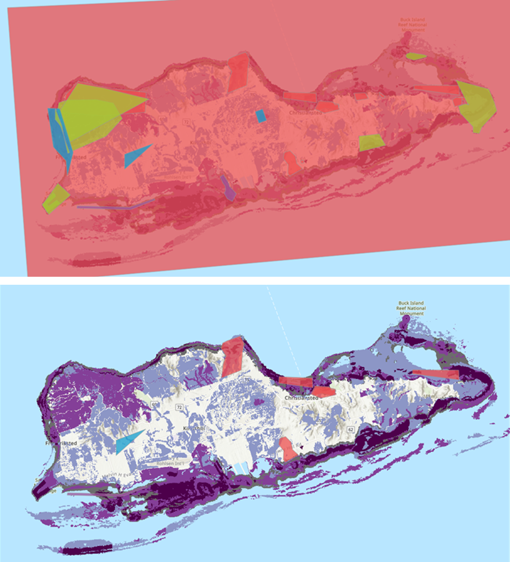
The major change to the Blueprint this year was expanding consistent methods to the U.S. Caribbean and open ocean of the Gulf of Mexico and some missing parts in the Atlantic. As part of that expansion, there are now 18 new Caribbean indicators for land, freshwater, and marine ecosystems. There are 9 new or improved indicators for the continental marine areas. You can see a brief overview of the indicators in this 2023 indicator “cheat sheet”.
Huge thanks to the 91 people from 41 organizations who attended workshops and provided feedback on the draft version. Part of that feedback comprised spatial comments on where the Blueprint could be improved. In the final version, we managed to either fully or partially fix about 43% of them in the Caribbean (9 total) and 42% in the continental marine (5 total). The known issues we couldn’t fix this year are now documented on the website and included in the Blueprint development process. We’ll use those that remain to guide future updates to the Blueprint.
The Blueprint data and documentation are now available on the Blueprint page of the SECAS Atlas. The SECAS Atlas is an online mapping platform built in ArcGIS Hub. In the Atlas, you can download the data and documentation, view individual indicators, and make maps with Blueprint layers and other data. There’s even a quick start map that includes all the indicators and other underlying Blueprint data.
We’re also close to updating the Blueprint Explorer with the 2023 data. The Explorer is more of a Google Maps-style interface that lets you quickly summarize and explore Blueprint information. This is also the interface that lets you upload shapefiles and get fancy reports with things like indicator tables/maps and information on sea-level rise and urban growth for your specific area. While we put the finishing touches on the Explorer update, you’re welcome to request a Blueprint 2023 report by contacting a member of the user support team. We’re also happy to help if you’d just like some assistance with incorporating this latest version of the Blueprint into your work.
Want to learn more and ask questions about this Blueprint update? Tune in to the November Third Thursday Web Forum on 11/16 @ 10 am ET. No advance registratoin is required–just join the Teams meeting at that date and time!