Introducing the Midwest Conservation Blueprint
Wildlife don’t see state or regional boundaries as borders, and neither do the folks at the Midwest Landscape Initiative (MLI). That’s why we’re excited to unveil a new product that will make collaborating to conserve lands and waters across the Midwest a whole lot easier.
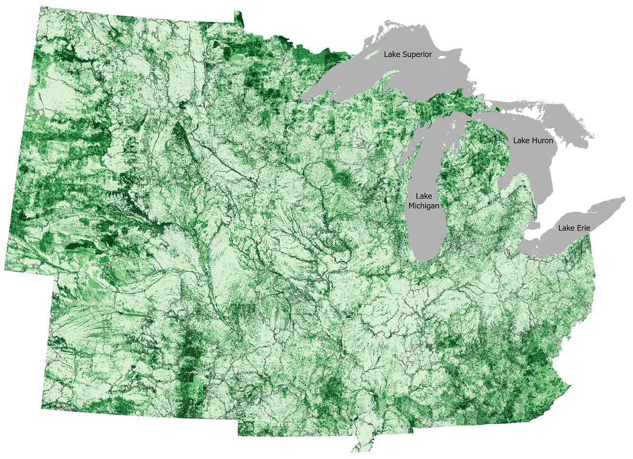
The Midwest Conservation Blueprint is a basemap of priority lands and waters for conservation. It reflects more than 20 social and environmental values across society that will achieve a thriving landscape of healthy lands and waters supporting wildlife, fish, and plants, embraced by all who live, work, and recreate in the Midwest. Specifically, it serves as an invitation to improve coordination of voluntary conservation actions and investments across the Midwest by:
- Focusing and aligning conservation work across organizations;
- Attracting and directing funding for conservation; and
- Connecting partners and welcoming everyone.
The blueprint is co-produced by conservation professionals and academics across the region, with active collaboration from over 50 individuals from more than 12 organizations contributing to the development. It is not intended to supersede local knowledge and authority, or to tell anyone where they should or should not work. Instead, it is a basemap upon which you can overlay your own maps, priorities, and plans to connect to a broader network of conservation practitioners.
Unique regions, shared approaches
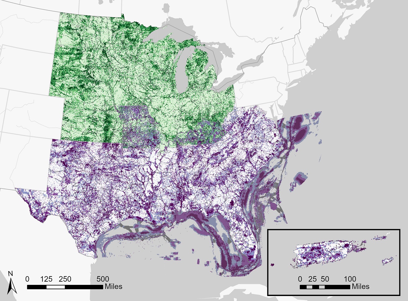
The spirit of cross-jurisdictional collaboration core to the MLI’s work is what made the creation of the Midwest Conservation Blueprint successful. We leaned on the knowledge and expertise of SECAS staff to adapt their methodologies for the Midwest region. Many of our analytical steps and several of our input data layers are shared with the Southeast Conservation Blueprint, which allows for more seamless integration.
That’s not to say the two blueprints are the same. In fact, the differences between the Midwest and Southeast Blueprints make each resource stronger, as each blueprint reflects priorities and issues specific to its region. The areas where we have shared geography not only allow for comparison and discussion between the MLI and SECAS but affords the user flexibility to select which blueprint better represents their priorities. By creating complementary—but not identical—products, conservation practitioners all the way from the Great Lakes to the Gulf Coast now have a regionally specific blueprint to guide their work.
Connect with the Midwest Landscape Initiative
Whether your interest in the Midwest landscape is to conserve birds, improve water quality, or something else entirely, the Midwest Conservation Blueprint can be a useful tool to support your work. We are here to assist you! If you’d like help from MLI staff to guide grant proposals, inform conservation decisions, connect you with others, or support any other component of your work, please contact us.
Webinars are ongoing to guide you through using the blueprint. Visit the MLI website to view a recording of our October 2023 blueprint webinar and register for our upcoming “Ask a Blueprint Question” interactive workshop.
To stay up to date with the MLI, sign up for email updates.