Southeast Blueprint 2021 now available
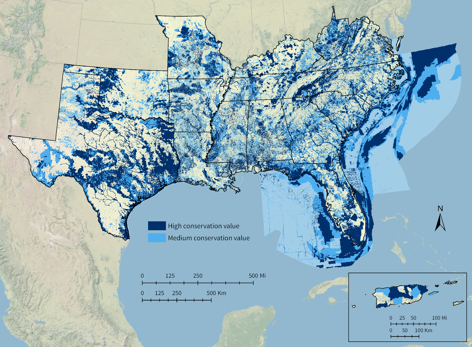
The latest update to the Southeast Conservation Blueprint, version 2021, is now available! This year’s Blueprint is a stepping stone to the bigger improvements in store next year, as we move toward consistent methods and indicators across most of the region.
The major improvements over the last version include:
- Incorporating the newest South Atlantic Blueprint data
- Correcting a scoring issue in the Middle Southeast
In many ways, the this year’s new South Atlantic Blueprint served as a test area for many of the improvements in store for a larger swath of the geography in the 2022 Southeast Blueprint. It used lots of updated and improved indicators, including better depictions of equity, deep-sea coral, fire, and important grassland areas. The South Atlantic Blueprint also improved its approach to connectivity across both inland and marine corridors. To read more about the improvements in the South Atlantic portion of this new Southeast Blueprint, »check out Rua’s blog on the South Atlantic website.
You can access the data and documentation in the Southeast Blueprint 2021 Data Gallery on the Southeast Conservation Planning Atlas (CPA), or download it all directly here if you prefer to use your desktop GIS.
We’re updating the beta viewer for the Southeast Blueprint to the latest data. You should see the new version in the viewer this week!