SECAS products in the works for 2020
As you probably know by now, we try to have updated or new products ready in October for the Southeast Association of Fish and Wildlife Agencies (SEAFWA) meeting. Here are the things we plan to have ready for this October:
-
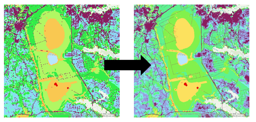
Update of the Southeast Conservation Blueprint: There are lots of cool improvements in the works for the various regional Blueprint inputs, including finer resolution in the South Atlantic, improved marine indicators in Florida, and much more.
-
A prototype viewer for the Southeast Conservation Blueprint:. This viewer will let you look below the broad categories so you can see why different places are a priority. More on that soon.
-
Updated Recent Trends in Southeastern Ecosystems report: In addition to using the latest data, we also have an improved approach for state-level water quality trends and a way to include state-level trends in invasive plants (you can find the current report on the goal page).
-
A report on SECAS governance and recommended future directions: Read more about that on Mallory’s SECAS for the future blog from last month.
For those of you that were at last year’s SECAS workshop, or were at a state-specific workshop, the Points of Contact have also reviewed your ideas for SECAS. Some of those are incorporated into improvements in the 4 products I listed above. For others, like the collaboration atlas, learning network, and terrestrial barriers to connectivity, we’re scoping them out and trying to make a little progress on them, too.
Lots of cool stuff on the way this year and we can’t wait to share it all with you!