The Nature Conservancy’s Resilient Coastal Sites for Conservation in the South Atlantic and the Gulf of Mexico
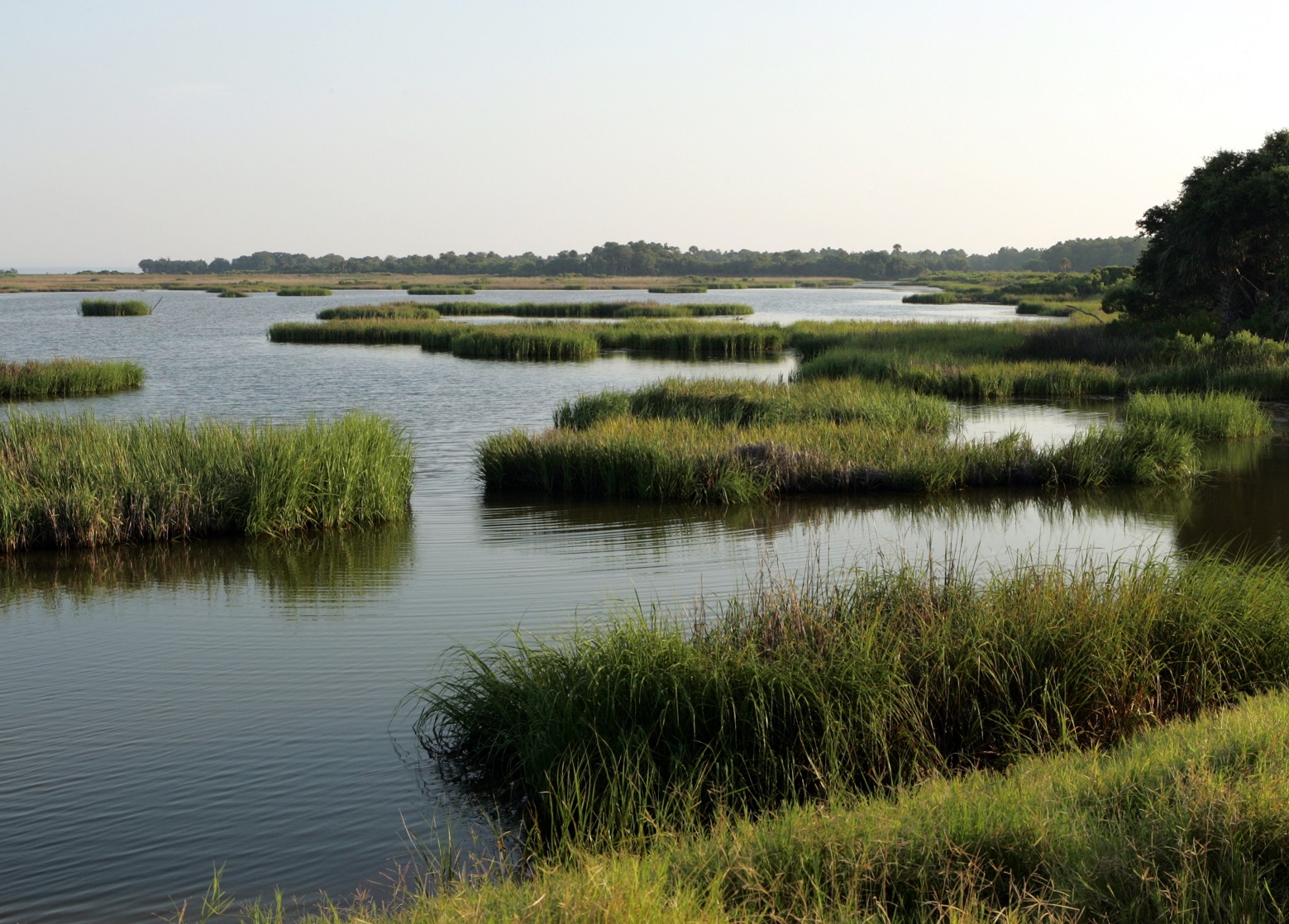
Our coastal and estuarine environments are key areas to build and sustain resiliency in the face of climate change. These places provide important habitats for wildlife and provide vital ecosystem services like shoreline stabilization, water filtration, food production, and recreational opportunities. Estuaries also contribute to the national, state, and local economies. Yet our coastal and estuarine systems are rapidly changing and transitioning due to sea-level rise, flooding, and extreme storm events. If extreme predictions for sea-level rise prove true, 77% of the South Atlantic region’s tidal habitats could be lost to rising waters, along with 98% of tidal habitats in the Gulf of Mexico.
Given the dynamic and inherently changing nature of our coastal ecosystems, finding the places where conservation actions will have the most impact is challenging. The Nature Conservancy recently completed its Resilient Coastal Sites for Conservation in the South Atlantic and the Gulf of Mexico. Combined with the existing Northeast and Mid-Atlantic data, released in 2017, information on Resilient Coastal Sites is now available for the entire SECAS coastline. These new tools can help identify places that can sustain biodiversity and ecosystem function for now and in the future. The results from the study include a report, web map, and spatial dataset that identifies resilient coastal sites.
Scientists from TNC evaluated more than 1,200 coastal sites in the South Atlantic and 1,500 in the Gulf of Mexico, all containing tidal marsh and other tidal habitats. They gauged the ability of tidal complexes to adapt to sea-level rise and climatic changes. Shared conservation action could offset almost 80% of the estimated tidal habitat loss in the South Atlantic, and increase Gulf of Mexco tidal habitat by 200%.
There are many ways to use this results of this project to plan for the future. Land trusts and other organizations specializing in land protection can use the dataset to find important migration spaces for resilient sites and see where they overlap with areas predicted to urbanize or develop. Similarly, local municipalities can use this data to look at the best areas to manage to help buffer communities from the effects of storms and floods. Results from this project provide tools for natural resource managers and conservation practitioners to find places to concentrate their actions and help tidal habitats expand and migrate.
You can access the results for each region on TNC’s website:
For a more in-depth overview of the South Atlantic results, check out the recording of last month’s South Atlantic Third Thursday Web Forum, where TNC’s Analie Barnett presented on this project.