Southeast Blueprint 4.0 finalized
Update: Looking for the latest Southeast Blueprint data? Visit the Southeast Blueprint 2020 Data Gallery.
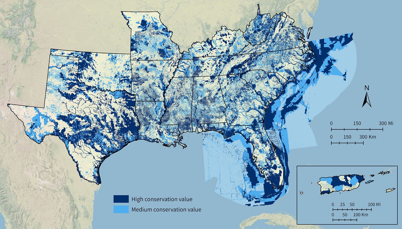
Southeast Blueprint Version 4.0 is now finalized! It was presented and reviewed at the Southeast Association of Fish and Wildlife Agencies (SEAFWA) annual meeting a couple of weeks ago. Since no one raised any concerns or caught any mistakes, it’s officially ready to use.
We made lots of great improvements this year, including:
- Fixed the overprioritization in Texas, Oklahoma, and the mountains of West Virginia and Virginia
- Improved priorities in the Lower Mississippi Valley, Louisiana marshes, and the Southern Appalachians
- Updated inputs from Florida and the Middle South
- Expanded marine coverage to fully include state and federal waters around Florida
- Hubs and corridors layer now includes all of Florida
You can learn more about the Southeast Blueprint on the Blueprint webpage. To explore the data, visit the Blueprint 4.0 Data Gallery on the Southeast Conservation Planning Atlas. The gallery also includes:
- A link to download all the Blueprint data in one easy package
- Complementary data layers depicting connectivity, the extent of the subregional inputs used in the Blueprint, and threats
- The Southeast Blueprint 4.0 development process document, which explains how the Blueprint is put together
- The updated Southeast Blueprint user guide, which provides step-by-step instructions and case studies on how to use the Blueprint
- A brand new changelog, which tracks the changes and improvements made in each version of the Blueprint
If you’re interested in using the Southeast Blueprint to support a proposal or inform your decision-making, reach out to the user support lead for your state.