Southeast Conservation Blueprint 2024 now available

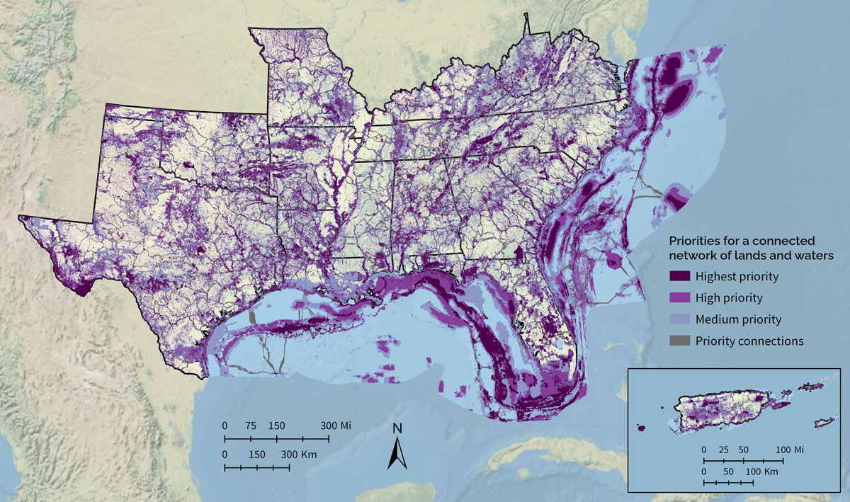
The latest update to the Southeast Conservation Blueprint, version 2024, is now available!
Here are the major improvements for this year:
- Improvements for 12 indicators covering terrestrial, freshwater, and marine
- Two new indicators: landscape condition and grasslands and savannas
- Major updates to three indicators: imperiled aquatic species, amphibian and reptile areas, and gulf coral and hardbottom
- Smaller updates to five more indicators
- There’s a brief overview of all indicators in the 2024 Blueprint in the indicator “cheat sheet”
- Improved prioritization methods to better account for regional variation
- We made some improvements to the methods that both highlight regionally significant areas while still supporting balance across ecoregions
- Freed up extra time for user support
- We took on a little less this year so user support staff could spend more time working closely with people interested in using the Blueprint. So far, the Southeast Conservation Blueprint has helped bring in $270 million in conservation funding to help protect and restore 315,000 acres. If you’re interested in using the Blueprint, please contact a member of the user support team. We love helping people use the Blueprint to strengthen grant proposals and inform their conservation decisions. It’s free and helping you use the Blueprint helps us improve future versions to make it even more useful to you and others.
You can explore the new data on Blueprint Explorer. The Explorer is a Google Maps-style interface that lets you quickly summarize and explore Blueprint information. This is also the interface that lets you upload shapefiles and get fancy reports with things like indicator tables/maps and information on sea-level rise and urban growth for your specific area. Please note the Explorer has a new web address (see Hilary’s blog for more information).
The Blueprint data and documentation are also available on the Blueprint page of the SECAS Atlas. The SECAS Atlas is an online mapping platform built in ArcGIS Hub. In the Atlas, you can download the data and documentation, view individual indicators, and make maps with Blueprint layers and other data. There’s even a quick start map that includes all the indicators and other underlying Blueprint data.
We’re also happy to help if you’d just like help incorporating this latest version of the Blueprint in your work. You can contact a member of the user support team and they’ll help you with things like making maps and combining Blueprint info with other local data and information you have.
Want to learn more and ask questions about this Blueprint update? Tune in to the November Third Thursday Web Forum on 11/21 @ 10 am ET. No advance registration is required–just join the Teams meeting at that date and time! It’s also not too late to sign up for a virtual Blueprint workshop–these run through November 7th.