Blueprint Explorer updated with 2024 data and new web address
The Southeast Conservation Blueprint Explorer has been updated to the latest Blueprint–version 2024! Please note that the web address for the Explorer has changed to: https://apps.fws.gov/southeastblueprint/. The links from the SECAS website have obviously been updated, but if you have the Explorer bookmarked locally, please update that as well!
Why the change? Essentially, we’re saving a significant amount of money on web hosting costs by moving to another secure platform that recently became available. As users of the tool, we hope you won’t notice any difference (beyond the new 2024 data).
Interestingly, this is the first year that the Blueprint Explorer has been updated with the latest version of the Blueprint in time for the official release! In the past, we’ve launched the Blueprint in the data download package and on the SECAS Atlas, and the Explorer has lagged behind a few weeks. As staff, we’ve found it challenging (and a bit anti-climactic) to have users asking for help with Blueprint 2024, but not have access to the automated reporting in the Explorer. We also imagine it may have been confusing for users to hear a lot of fanfare about the latest Blueprint, only to go to the viewer and still see the previous version.
We adjusted our timeline to allow more space to update the Explorer before the release, and we’re a lot happier with the result. We hope you will be, too! We’ll strive to continue this in future years–hopefully it will only be easier when we aren’t simultaneously having to navigate migrating to another cloud hosting platform!
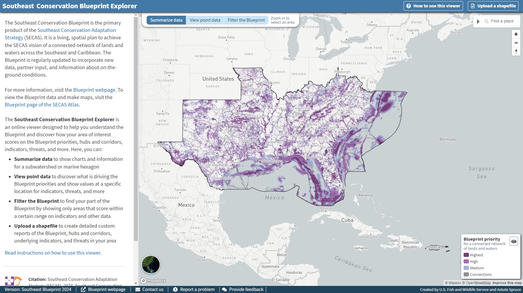
If you aren’t familiar with the Blueprint Explorer yet, I highly recommend you check it out. It is a simple online viewer designed to help you understand the Blueprint and discover how your area of interest scores on the Blueprint priorities, hubs and corridors, indicators, threats, and more. There, you can:
- Summarize data to show charts and information for a subwatershed or marine hexagon
- View point data to discover what is driving the Blueprint priorities and show values at a specific location for indicators, threats, and more
- Filter the Blueprint to find your part of the Blueprint by showing only areas that score within a certain range on indicators and other data
- Upload a shapefile to create detailed custom reports of the Blueprint, hubs and corridors, underlying indicators, and threats in your area
Check it out and email me at hilary_morris@fws.gov with any questions or to ask for help!