Four indicator review opportunities for grasslands and savannas, Gulf coral and hardbottom, forest bird habitat, and landscape condition
Are you knowledgeable and passionate about Southeast forest birds, coral and hardbottom in the Gulf of Mexico, overall patterns of landscape connectivity and fragmentation, or grasslands and savannas? If so, we need your help to improve several indicators in this year’s update to the Southeast Conservation Blueprint–version 2024! As always, we rely on feedback from the broader SECAS community, from Blueprint users to subject matter experts to on-the-ground conservation practitioners, to drive the Blueprint development cycle.
Four indicator review teams are now looking for expert volunteers to help provide feedback during the month of March:
- Grasslands & savannas
- Gulf coral & hardbottom
- Forest bird habitat
- Landscape condition
The time commitment is minimal–just a 1-hr virtual meeting! This is a fantastic way to get more involved in the Blueprint and make sure that the places you know and love are represented correctly. You’ll be reviewing a draft of the indicator and providing your input on the data, methods, and approaches we’re considering so far. To sign up, just register via the Zoom links below.
Grasslands & Savannas
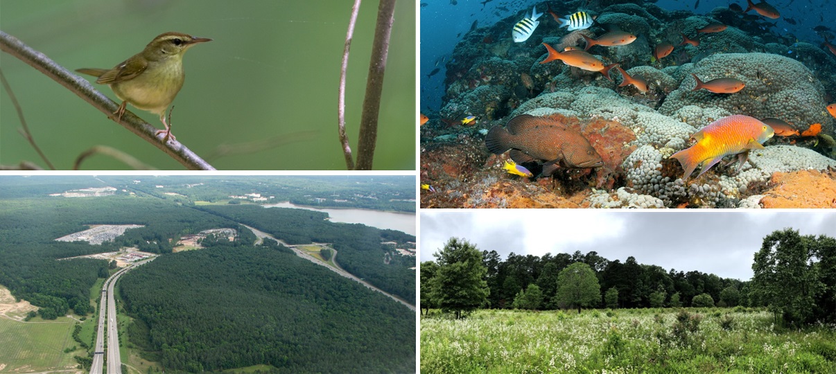
You may have already seen Emily’s invitation to review the grasslands and savannas indicator in last month’s newsletter. If you missed it, it’s not too late to sign up! This indicator is intended to capture important known, potential, and historic grasslands and open tree savannas across the Southeast.
- Monday, March 4, 2024 @ 11 am ET/10 am CT: Register via Zoom
- Thursday, March 7, 2024 @ 2 pm ET/1 pm CT: Register via Zoom
Gulf Coral & Hardbottom
This indicator is meant to represent natural and artificial reefs and hardbottom habitats within the Gulf of Mexico, which are important for diverse marine life.
- Monday, March 11th @ 2 pm ET/1 pm CT: Register via Zoom
- Thursday, March 14th @ 11 am ET/10 am CT: Register via Zoom
Forest Bird Habitat
This indicator is meant to broadly capture important habitats for forest birds across the continental Southeast. It’s intended to complement the existing subregional bird models developed by various Joint Venture partnerships, some of which are already incorporated into the Blueprint, to provide consistent regionwide coverage.
- Tuesday, March 19th @ 11 am ET/10 am CT: Register via Zoom
- Thursday, March 21st @ 2 pm ET/1 pm CT: Register via Zoom
Landscape Condition
This indicator is envisioned to represent natural areas with limited human alteration while also considering the natural landcover of the surrounding landscape. The degree of naturalness across the landscape is a key ecological condition for sustaining species and ecosystem services that are sensitive to habitat fragmentation at multiple scales.
- Tuesday, March 26th @ 10 am ET/9 am CT: Register via Zoom
- Wednesday, March 27th @ 2 pm ET/1 pm CT: Register via Zoom