The Water Institute of the Gulf releases final reports for suite of SECAS projects
Last month, the Water Institute of the Gulf wrapped up a series of projects funded by a cooperative agreement with the U.S. Fish and Wildlife Service entitled “Advancing the goals of SECAS: A program to improve Southeast Conservation Blueprint utility in the Gulf of Mexico.” The broader goal of this effort is to increase the utility and application of the Southeast Conservation Blueprint in the Gulf by collecting, improving, and coordinating existing datasets. This work meets a need in the northern Gulf of Mexico for actionable, science-based tools due to both natural and anthropogenic threats to key habitats and ongoing large investments in land management, conservation, and restoration.
This effort encompassed three modular and scalable projects within the Gulf of Mexico:
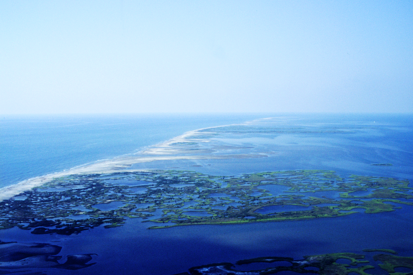
- The Chandeleur Island component illustrated the use of the Southeast Conservation Blueprint for project-level implementation. This effort explored new modeling of this dynamic island chain and the development of novel ecosystem metrics for evaluating dynamic barrier island ecosystems. Read the final report for this project here.
- The restoration planning component investigated intersections between SECAS, the Southeast Conservation Blueprint, and Louisiana’s key state planning mechanism—the Louisiana Coastal Master Plan. It demonstrated how SECAS Gulf-wide data metrics could be used for evaluating marsh creation projects. Read the final report for this project here.
- The Gulf-wide integration component generated synergistic, consistent Gulf-wide data analyzing potential natural resource value, ecosystem stress, and social vulnerability to increase the utility of SECAS in the northern Gulf of Mexico. The Water Institute Team developed synthetic data layers to complement the existing Southeast Conservation Blueprint while adding additional data to increase relevance for Gulf-wide conservation and restoration planning. Read the final report for this project here.
These documents complement the Southeast Conservation Blueprint Mechanics report, which discusses the overall framework of SECAS and the Southeast Conservation Blueprint and examines the history, governance structure, framework, and methodology that underpin five of its subregional blueprints. This April blog by Water Institute staff discusses that Blueprint Mechanics report in more detail.
Visit the Water Institute of the Gulf website to learn more about the various projects.