From the archive - Southeast Blueprint now on the Southeast Conservation Planning Atlas
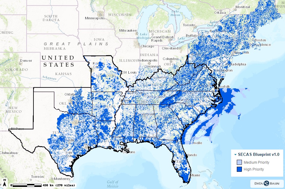
Version 1.0 of the Conservation Blueprint for the Southeast Conservation Adaptation Strategy (SECAS) is now available on the Southeast Conservation Planning Atlas. This spatial plan integrates the input data from 8 different LCCs to identify the highest priority areas for conservation across the Southeast. It will be updated annually to incorporate the most current information from each LCC. It currently uses the most recent version of the South Atlantic Blueprint, Version 2.1.
- Read Mallory’s reflections on the leadership summit, where Southeast Blueprint 1.0 was first unveiled
- Learn more about the SECAS effort to design and achieve a connected network of landscapes and seascapes that supports thriving fish and wildlife populations and improved quality of life for people across the Southeast and Caribbean
- See a factsheet on SECAS