![]()
SECAS brings together public and private organizations around a bold vision for the future of our region. We're connecting the lands and waters of the Southeast and Caribbean to support healthy ecosystems, thriving fish and wildlife populations, and vibrant communities. With a data-driven spatial plan and an ambitious regional goal, SECAS helps accelerate conservation action in the places where it will make the biggest impact.
From the blog
-
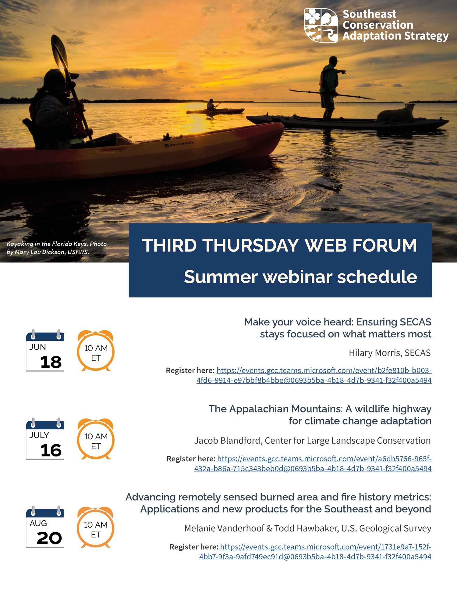
Upcoming webinars in the SECAS Third Thursday Web Forum series. Summer 2026 web forum flyer schedule announced
The Third Thursday Web Forum schedule for June, July, and August is now available! SECAS hosts these webinars on the third Thursday of each month at 10 am Eastern time. »Click here for an interactive pdf of the flyer, with functioning links.
- June 18th @ 10 am ET: Make your voice heard: Ensuring SECAS stays focused on what matters most. The June web forum will offer a unique opportunity for attendees to actively participate in shaping the focus of the SECAS partnership. In the face of recent disruption and loss of capacity, staff are seeking feedback on how to best balance competing priorities and ensure that the partnership sustains the products and services that matter most to our community. Register here: https://events.gcc.teams.microsoft.com/event/b2fe810b-b003-4fd6-9914-e97bbf8b4bbe@0693b5ba-4b18-4d7b-9341-f32f400a5494.
-
.jpg)
Neal Smith National Wildlife Refuge in Iowa. Photo by Doreen Van Ryswyk, U.S. Fish and Wildlife Service. Midwest Landscape Initiative - An Innovative Partnership in the Midwest
The second of three spotlights on neighboring landscape conservation initiatives, cross-posted from the Wildlife Management Institute’s Outdoor News Bulletin September 2025 Edition - Volume 79, Issue 9
The Midwest Landscape Initiative (MLI) brings people together to catalyze conservation solutions. Founded in 2018 by leadership from state and federal fish and wildlife agencies, MLI embarked on a new effort to convene state, federal, and other conservation partners to collaboratively develop solutions to our shared priority conservation challenges. At their August 2025 retreat, MLI partners updated the vision and mission statement for the regional landscape collaboration.
Read more... -
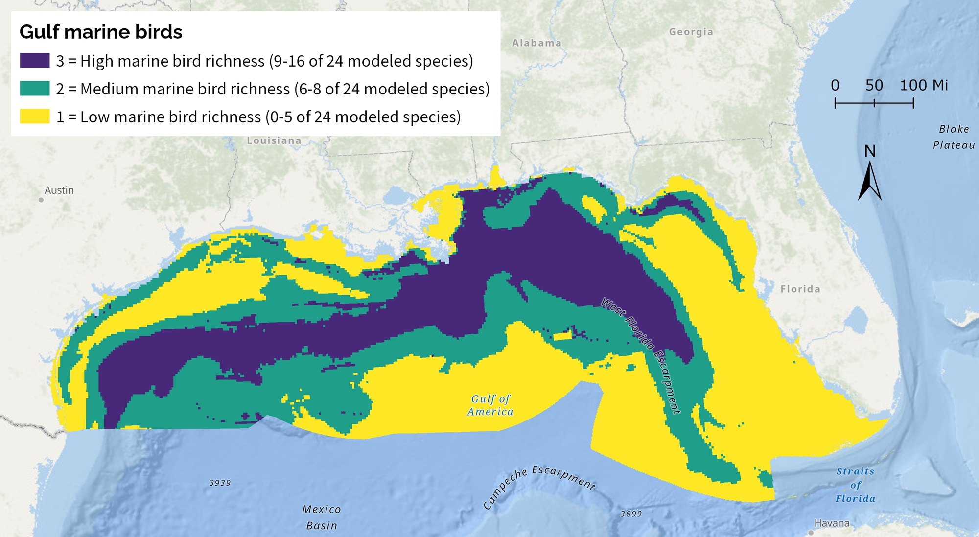
Gulf marine birds is one of the new indicators planned for Blueprint 2026, scheduled for release this fall. Five new indicators for Blueprint 2026
We’ve got some very exciting updates on the way for Southeast Conservation Blueprint 2026. While all the data and documentation won’t be out until later this year, I still wanted to give you a heads up on the indicator improvements on the way.
- Caribbean imperiled aquatic species - This new indicator covers both Puerto Rico and the U.S. Virgin Islands. It combines existing information and new survey data.
Visit the SECAS blog for a full archive of posts.