Indicator improvements in the 2025 Conservation Blueprint
I’m glad to announce that, despite all the recent federal changes, SECAS staff are continuing to improve the Blueprint and are on track to release the Blueprint in October. There are lots of great improvements in there–including new species indicators, a new indicator for a Tribally important plant (rivercane restoration), a new grassland and savanna restoration indictor, three new indicators in the Caribbean, an indicator co-developed with the Midwest Landscape Initiative (lakes and reservoirs), and lots more.
Here’s a sneak peek at Blueprint indicator improvements for 2025. When the Blueprint is released in October, the indicators will be up on the SECAS Atlas, Blueprint Explorer, and publicly available to download (along with the detailed documentation and code).
New Indicators
- Imperiled mammals identifies potential habitat to support mammal Regional Species of Greatest Conservation Need (RSGCN).
- Imperiled amphibians & reptiles identifies potential habitat to support amphibian and reptile RSGCN.
- U.S. Virgin Islands imperiled species identifies potential habitat to support terrestrial species across the U.S. Virgin Islands.
- Rivercane restoration represents priority places for river cane restoration and co-stewardship near the lands of federally recognized Tribes.
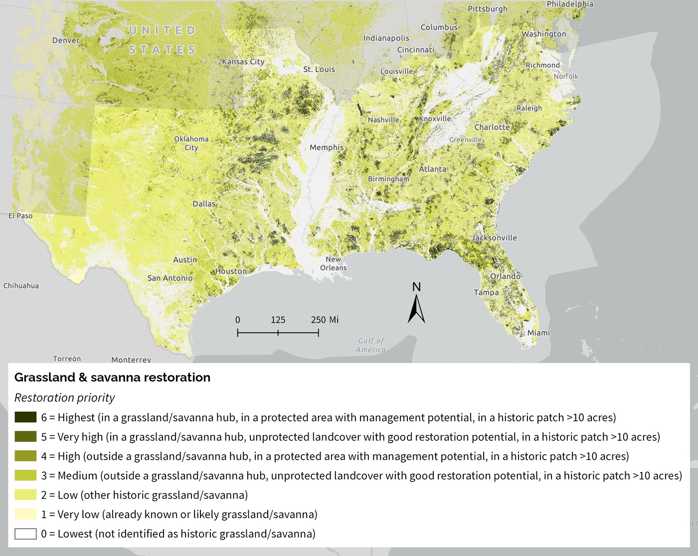
- Grassland & savanna restoration represents potential restoration opportunities for grasslands and savannas within their historic range in the southeastern United States.
- Lakes & reservoirs assesses the condition of lakes and reservoirs based on the amount of natural landcover within the upstream watershed.
- Floodplain inundation uses the frequency of inundation to measure the hydrologic function of the floodplain.
- Puerto Rico potential access to parks prioritizes places to create new parks that would fill gaps in access to open space within socially vulnerable communities in urban areas.
- Caribbean mangrove migration represents current and potential future locations of mangroves based on land cover and barriers to mangrove migration like slope, elevation, and development.
Major Updates
- Grassland & savanna extent (previously grasslands & savannas) now has an improved way to deal with tree encroachment in historically treeless grasslands, a new approach for clustering using grassland and savanna hubs, better identification of likely grasslands and savannas, new known grasslands, and other improvements. It also has a new name to reduce confusion with the new grassland and savanna restoration indicator.
- Landscape condition now treats tree-encroached grasslands out west as altered, treats the open water in reservoirs as altered, and uses the latest grassland and savanna extent indicator to correct for misclassification of grassland and savanna.
Minor Updates
- Potential access to parks now uses the latest version of the Trust for Public Lands ParkServe database.
- Resilient coastal sites now uses a better approach for connecting with resilient terrestrial sites indicator.
- Resilient terrestrial sites now uses a better approach for connecting with resilient coastal sites indicator.