The Southeast Blueprint Indicators
This page is coming soon! In the meantime, you can see the list of indicators used in the 2024 Blueprint on this “cheat sheet” or check out the Blueprint page of the SECAS Atlas.
TEST
The Southeast Conservation Blueprint is based on 60 natural and cultural resource indicators that represent terrestrial, freshwater, and coastal/marine ecosystems.
Navigation Links
Continental
Caribbean
-
Continental Indicators
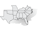
15 Southeast states + U.S. Atlantic and Gulf waters
-

Terrestrial
Inland terrestrial ecosystems
- Amphibian & reptile areas (MARKED FOR REMOVAL IN BLUEPRINT 2025): Identifies important herpetofauna habitat designated as Priority Amphibian and Reptile Conservation Areas (PARCAs)
- Source: Amphibian and Reptile Conservancy
- East Coastal Plain open pine birds: Identifies areas within the longleaf pine range east of the Mississippi River where open pine habitat management would most benefit 6 bird species
- Source: East Gulf Coastal Plain Joint Venture (JV)
- Fire frequency: Estimates the number of times an area has been burned from 2013-2021
- Source: Landsat Burned Areas, Monitoring Trends in Burn Severity
- Grasslands & savannas: Evaluates the condition of open grasslands and tree savannas
- Source: Protected Areas Database of the United States (PAD-US), NLCD, LANDFIRE, TX & OK ecological systems maps, Piedmont Prairie Partnership, Southeastern Grasslands Institute/iNaturalist, other expert-provided known sites
- Grassland & savanna restoration (COMING SOON IN BLUEPRINT 2025): REPLACE PLACEHOLDER TEXT
- Source: PLACEHOLDER
- Greenways & trails: Assesses the natural condition and connected length of recreational paths
- Source: OpenStreetMap, NLCD
- Imperiled mammals (COMING SOON IN BLUEPRINT 2025): REPLACE PLACEHOLDER TEXT
- Source: PLACEHOLDER.
- Imperiled reptiles & amphibians (COMING SOON IN BLUEPRINT 2025): REPLACE PLACEHOLDER TEXT
- Source: PLACEHOLDER
- Intact habitat cores: Measures the size of large, unfragmented patches of natural habitat
- Source: Esri green infrastructure data
- Landscape condition: Represents natural areas with limited human alteration while also considering the naturalness of the surrounding landscape
- Source: NLCD, LANDFIRE, grasslands & savannas indicator
- Mississippi Alluvial Valley forest birds - protection: Prioritizes new areas for protection to benefit 3 forest breeding bird species that need large interior cores of bottomland hardwood habitat
- Source: Lower Mississippi Valley Joint Venture - LMVJV
- Mississippi Alluvial Valley forest birds - reforestation: Prioritizes areas for reforestation to benefit 3 forest breeding bird species that need large interior cores of bottomland hardwood habitat
- Source: LMVJV
- Playas: Depicts the location and condition of playas in the western Great Plains
- Source: Playa Lakes JV
- Potential access to parks: Prioritizes places to create new parks to fill gaps in access to green space within socially vulnerable communities
- Source: Trust for Public Land ParkServe, Centers for Disease Control Social Vulnerability Index
- River cane restoration (COMING SOON IN BLUEPRINT 2025): REPLACE PLACEHOLDER TEXT
- Source: PLACEHOLDER
- Resilient terrestrial sites: Index depicting the ability of terrestrial sites to continue supporting biodiversity and ecosystem function in the face of climate change
- Source: TNC Resilient Land
- South Atlantic forest birds: Evaluates habitat suitability for 12 upland hardwood and forested wetland bird species
- Source: Southeast Gap Analysis Program (GAP), Designing Sustainable Landscapes
- South Atlantic low-urban historic landscapes: Assesses the degree of urban development surrounding sites on the National Register of Historic Places
- Source: National Park Service (NPS), State Historic Preservation Offices (SHPOs)
- Urban park size: Measures the size of parks in and near urban areas
- Source: PAD-US, OpenStreetMap, U.S. Fish & Wildlife Service (USFWS) realty tracts, NLCD, Census urban areas
- West Coastal Plain & Ouachitas forested wetland birds: Evaluates habitat suitability for 5 bird species within bottomland hardwood forests and riparian areas
- Source: LMVJV
- West Coastal Plain & Ouachitas open pine birds: Identifies areas with existing pine trees that, if managed for open condition, could support a population of 3 pine bird species
- Source: LMVJV
- West Gulf Coast mottled duck nesting: Depicts coastal marshes and grasslands in TX and LA that are important for mottled duck nesting
- Source: Gulf Coast Prairie Landscape Conservation Cooperative
-

Freshwater
Rivers, streams, lakes, and reservoirs draining into the Atlantic and Gulf
- Atlantic migratory fish habitat: Assesses migratory fish habitat condition based on water quality, connectivity, flow alteration, and more
- Source: Atlantic Coast Fish Habitat Partnership (ACFHP)
- Floodplain inundation (COMING SOON IN BLUEPRINT 2025): REPLACE PLACEHOLDER TEXT
- Source: PLACEHOLDER
- Gulf migratory fish connectivity: Depicts how far upstream migratory fish species have been observed
- Source: The Nature Conservancy (TNC) Southeast Aquatic Connectivity Assessment Project, National Oceanic and Atmospheric Administration (NOAA) critical habitat
- Imperiled aquatic species: Counts the number of aquatic Regional Species of Greatest Conservation Need observed in each watershed
- Source: Southeast Aquatic Resources Partnership (SARP) HUC12 species summaries, Environmental Protection Agency (EPA) estimated floodplain
- Lakes & reservoirs (COMING SOON IN BLUEPRINT 2025): REPLACE PLACEHOLDER TEXT
- Source: PLACEHOLDER
- Natural landcover in floodplains: Measures the percent natural landcover in the estimated floodplain by catchment
- Source: National Land Cover Database (NLCD), National Hydrography Dataset Plus high resolution (NHDPlus HR), EPA estimated floodplain
- Network complexity: Counts the number of connected stream size classes in a river network between dams or waterfalls
- Source: SARP network complexity data, NHDPlus HR, EPA estimated floodplain
- Permeable surface: Measures the average percent of non-impervious landcover within each catchment
- Source: NLCD, NHDPlus HR
-

Coastal & Marine
Coastal, estuarine, and marine ecosystems to the edge of U.S. waters
- Atlantic coral & hardbottom: Predicts the presence of coral and hardbottom habitat based on direct observations, distribution models, and known human-created structures
- Source: TNC South Atlantic Bight Marine Assessment; Blake Plateau coral mound data; NOAA deep-sea coral/sponge observations, shipwrecks, artificial reefs, hardbottom distribution data; FL artificial reefs
- Atlantic deep-sea coral richness: Measures the number of deep-sea coral genera predicted to occur offshore
- Source: NOAA deep-sea coral distribution data
- Atlantic estuarine fish habitat: Assesses estuarine fish habitat condition based on water quality, marsh edges, seagrass, oyster reefs, and more
- Source: ACFHP
- Atlantic marine birds: Identifies important areas for 19 bird species that feed exclusively or mainly at sea
- Source: Duke Marine-life Data & Analysis Team
- Atlantic marine mammals: Identifies important areas for 20 species and species groups of dolphins, whales, and seals
- Source: Duke Marine Lab
- Coastal shoreline condition: Evaluates shoreline condition based on the presence of hardened structures and ease of development in coastal areas
- Source: NOAA Environmental Sensitivity Index - ESI, Coastal Barrier Resource System
- Estuarine coastal condition: Assesses estuarine water quality, sediment quality, contaminants in fish tissue, and benthic community condition
- Source: EPA National Coastal Condition Assessment
- Gulf coral & hardbottom: Predicts the presence of coral and hardbottom habitat based on direct observations, acoustic surveys, and known human-created structures
- Source: Bureau of Ocean Energy Management seismic water bottom anomalies; usSEABED sediments; TNC South Atlantic Bight Marine Assessment; FL coral/hardbottom habitats; LA, TX, MS, AL & FL artificial reefs; NOAA deep-sea coral/sponge observations, shipwrecks
- Gulf deep-sea coral richness: Measures the number of deep-sea coral genera predicted to occur offshore
- Source: NOAA deep-sea coral distribution data
- Gulf marine mammals: Identifies important areas for 13 species or species groups of dolphins and whales
- Source: NOAA Gulf of Mexico Marine Assessment Program for Protected Species - GoMMAPPS
- Gulf sea turtles: Identifies important areas for 4 species of sea turtles
- Source: NOAA GoMMAPPS
- Island habitat: Identifies important habitat for island-dependent species
- Source: USFWS critical habitat, Esri/U.S. Geological Survey - USGS island boundaries
- Marine highly migratory fish: Identifies important foraging and spawning areas for 3 highly migratory fish species at various life stages
- Source: European Commission global fish models
- Resilient coastal sites: Assesses the ability of coastal sites to migrate inland to sustain biodiversity and natural services under increasing inundation from sea-level rise
- Source: TNC Resilient Coastal Sites
- Seagrass: Identifies seagrass locations
- Source: NOAA Marine Cadastre
- South Atlantic beach birds: Predicts habitat suitability for 4 shorebird species
- Source: bird data from USGS and state waterbird biologists
- South Atlantic maritime forest: Identifies maritime forest locations
- Source: LANDFIRE EVT
- Stable coastal wetlands: Evaluates marsh stability and resilience based on the ratio of plants to non-plants over time (e.g., open water or sediment)
- Source: USGS unvegetated-vegetated ratio data
-

Caribbean Indicators
Puerto Rico & the U.S. Virgin Islands + nearshore marine waters
-
Terrestrial
Inland terrestrial ecosystems
-
Freshwater
Caribbean rivers, streams, lakes, and reservoirs
-
Coastal & Marine
Caribbean coastal, estuarine, and marine ecosystems