The dynamic journey of Blueprint updates in the Gulf of Mexico
When it comes to Blueprint updates, expect the unexpected. These updates are the result of a complex interplay of many different factors, including data availability, staff capacity, partner input, and much more, which eventually culminate in the Southeast Conservation Blueprint. Today I would like to give some insight on the initial stages of our annual revision cycle, where we truly begin to see the heart of the process: the indicators.
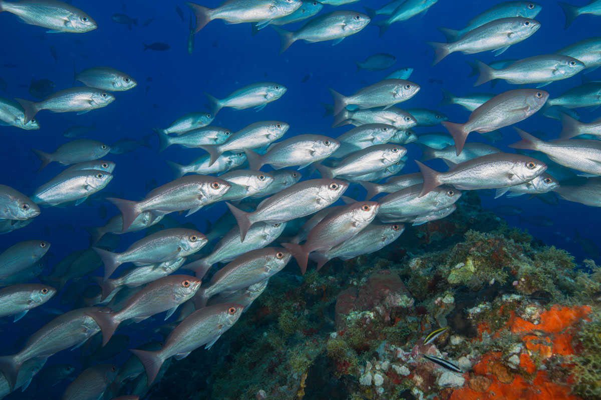
In 2023, we proudly extended the Blueprint into the Gulf of Mexico’s offshore marine environment. As we usher in the 2024 Blueprint update, we’re excited to share that updates in this area have already begun. Every time we update an indicator—whether it’s familiar or brand new—the experience is always unique. This dynamic process was particularly evident with our Gulf coral and hardbottom indicator.
Chasing New Data
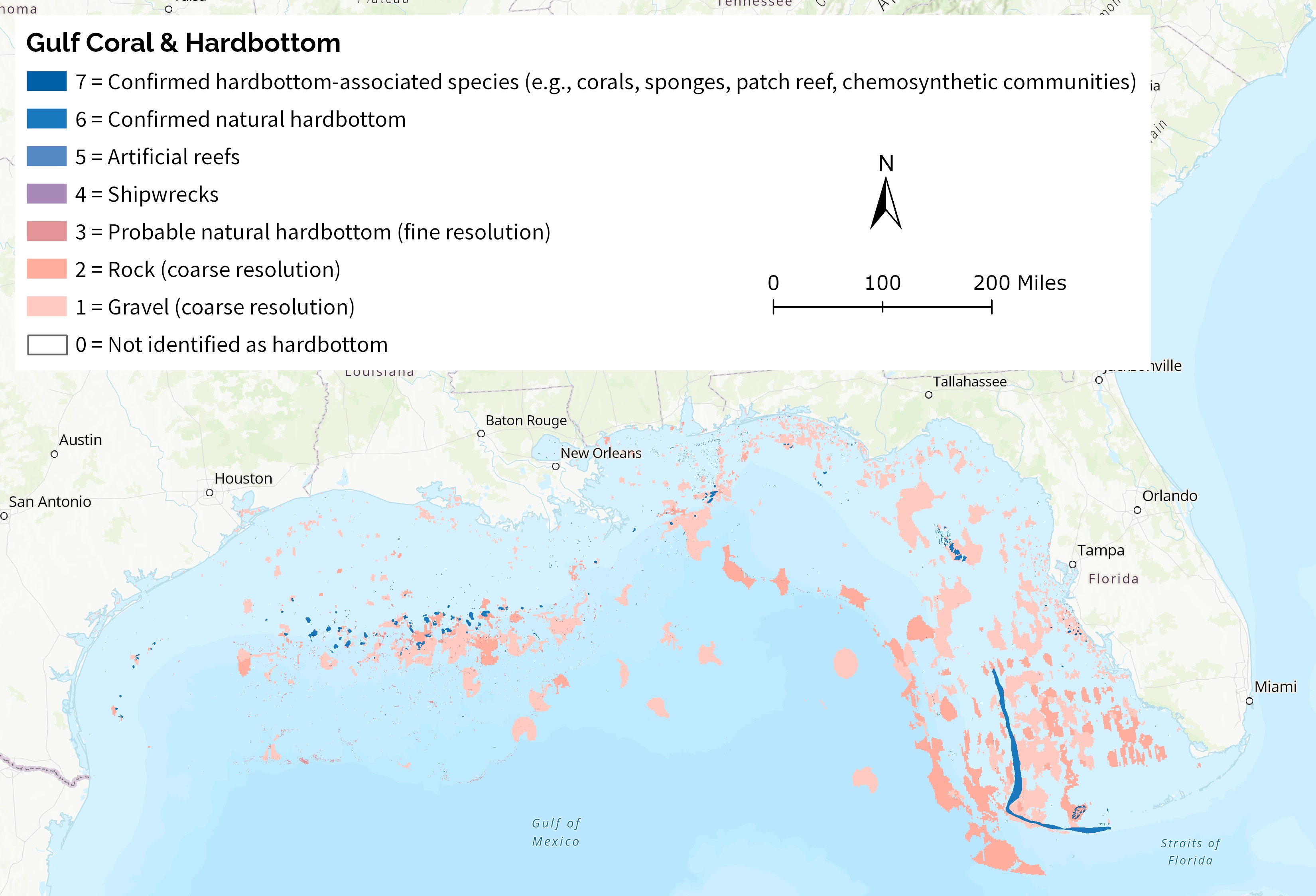
When SECAS staff commit to updating an indicator, we first form an internal indicator development team made up of a GIS lead, who is tasked with wrangling the data, and at least one user support lead, who ensures that data is presented in a way that makes sense and meets users’ needs. For our Gulf coral and hardbottom team, our journey began by scouting for new and updated data sources to enhance the existing indicator. For example, we tracked down improved data on artificial reef locations maintained by each Gulf state, and a new hardbottom and coral dataset hosted by the Florida Fish and Wildlife Conservation Commission. For weeks, our internal team engaged in discussions, weighing options on how best to incorporate and display the new and updated information. We debated the relevance of various elements, identifying what was vital, what made sense, and where cut-off points should lie. After an intense exchange of ideas, we reached a consensus and were ready to unveil the first draft of our findings for expert-driven feedback.
Seeking Expert Review
However, a new question arose: “Who should we show this to?” Just like a budding producer trying to find his audience at a farmer’s market, we had to identify the right stakeholders for our indicator review workshop. We began by reaching out to familiar contacts and colleagues, but we also sought out to find fresh perspectives, too—after all, we didn’t want to hear just the same old feedback. So, we asked our existing partners for recommendations on who else might be interested.
This process of outreach expanded quickly. We dug deep into our networks, contacted experts in academia, and connected with state and federal agencies. We wanted to include additional experts with specialized knowledge, such as state artificial reef coordinators and nonprofit organizations with interests in the Gulf of Mexico and the people who live in the surrounding area. We also wanted to incorporate university researchers who specialized in fisheries science and management, corals, and seabed geography to ensure that we had adequate representation in the review process. This required everything from crafting well-thought-out emails to, yes, making a few cold calls to gauge interest. Ultimately, we built a diverse group of stakeholders eager to engage, and we scheduled our workshops.
Diverse Perspectives
To our not-so-great surprise, the indicator review workshops sparked a plethora of differing opinions. The Gulf of Mexico encompasses a vast region with many varying interests and cultures, making diversity in viewpoints not just expected, but essential. The workshops proved to be fruitful, generating insightful debates, valuable suggestions, and a deeper understanding of the perspectives surrounding the Gulf. For example, we discussed the tradeoffs around whether to directly include coral Habitat Areas of Particular Concern or let finer-scale data sources represent important areas within them.
Refining the Indicator
After the workshops, our staff reconvened to sift through the feedback. We carefully evaluated the pros and cons of each piece of input to refine and revise our updated indicator. This iterative process was lengthy yet crucial, ensuring that the indicator wasn’t just data-driven but also user-centered, reflecting the insights of local experts who truly understand the nuances of the Gulf.
Through the process, we adjusted and made changes to what was initially presented to the group so that the indicator could be more useful to those it serves. These changes included the decision to split shipwrecks and artificial reefs into separate categories to better reflect the fact that artificial reefs are intentionally sited for conservation benefit, providing a clear distinction that highlights their unique roles and habitat values.
We also decided not to represent active oil and gas platforms due to the temporary nature of their existence and differing opinions across the Gulf states regarding their conservation benefits. We instead decided to focus on more permanent features that would contribute to a stable, shared understanding of the Gulf’s marine environment.
Additionally, we deliberated on the appropriate distance for the indicator to reach inshore, attempting to strike the right balance that would best align with our data sources, suit user needs, and demonstrate our commitment to those invested in the Gulf of Mexico. We further considered how to align the Gulf coral and hardbottom indicator with its sister indicator in the Atlantic, which also received an update this year.
After incorporating improvements to the draft indicator, we recirculated it with the expert reviewers for further feedback so we could make sure everybody was satisfied with the changes and were comfortable using it in the 2024 Blueprint update.
In conclusion, the path to updating indicators isn’t just about the data itself; it’s about listening, collaborating, and creating something that resonates with those it’s designed to serve. As we move forward, we remain committed to engaging with stakeholders and partners across the spectrum of the conservation landscape, ensuring our work in the Gulf of Mexico continues to progress in meaningful ways. Stay tuned for more updates as we embark on this exciting journey together!
Do you have any ideas for additional important indicator updates in the Gulf of Mexico? Check out one of our upcoming Blueprint workshops or reach out to me at adam_malcomb@fws.gov to share your thoughts!