Southeast Conservation Blueprint 2022 on track for final release this fall
We’re still on track to release Southeast Conservation Blueprint 2022 this fall. We’re planning to make it available by late October in time for the annual conference of the Southeastern Association of Fish and Wildlife Agencies (SEAFWA). We’re just finalizing the data and documentation and making everything publicly available online. Here’s what you can expect from this year’s release:
-
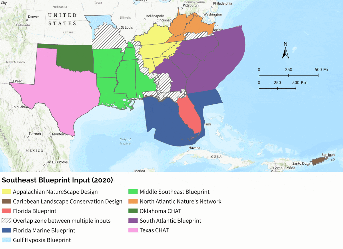
Consistent methods and underlying data for 15 states of the SECAS geography: We’ll be using the Base Blueprint 2022 priorities across the entire Southeast, and just stitching in two additional inputs: a new version of the Florida Marine Blueprint, and the Caribbean Landscape Conservation Design for Puerto Rico. This means the underlying data is even simpler and more consistent than we’d envisioned when we first embarked on this approach last year, when we were striving for coverage of 12 states!
-
Updated data and new features in the Blueprint Explorer viewer: The Blueprint Explorer viewer has been in beta for the last year. We’re working on updating the viewer to Southeast Conservation Blueprint 2022 and adding several new features. You’ll still be able to view summaries for HUC12 subwatersheds and create custom reports by uploading a shapefile. In addition, there will be a new “pixel mode” where you can drill into individual pixels to see how they score on the Blueprint, indicators, and threat data. We’re also introducing a filtering mode, where you’ll be able to highlight the parts of the Blueprint that align with your interests, based on their indicator scores. For example, if you wanted to identify the parts of the Blueprint that are good candidates for riparian buffer restoration, you could filter the Blueprint to identify areas with lower scores on the “natural landcover in floodplains” indicator.
-
New ArcGIS Hub mapping portal: For those who want to be able to explore the Blueprint and underlying data layers online in more detail–outside of a desktop GIS environment–we’re also creating a new ArcGIS Online Hub to serve as a mapping platform for SECAS. This will replace the Southeast Regional Conservation Planning Atlas (CPA), but provide the same sorts of functionality. You’ll be able to view each layer associated with the Blueprint, read how each one was created, create maps overlaying multiple data layers, and more. As always, the spatial data and documentation will be available to download into your desktop GIS, too.