A conservation plan for the people

The Blueprint, by the Southeast Conservation Adaptation Strategy, is helping to make collaborative conservation a reality across the South
Shared from an article in the “Wild Weekly” newsletter of the U.S. Fish and Wildlife Service
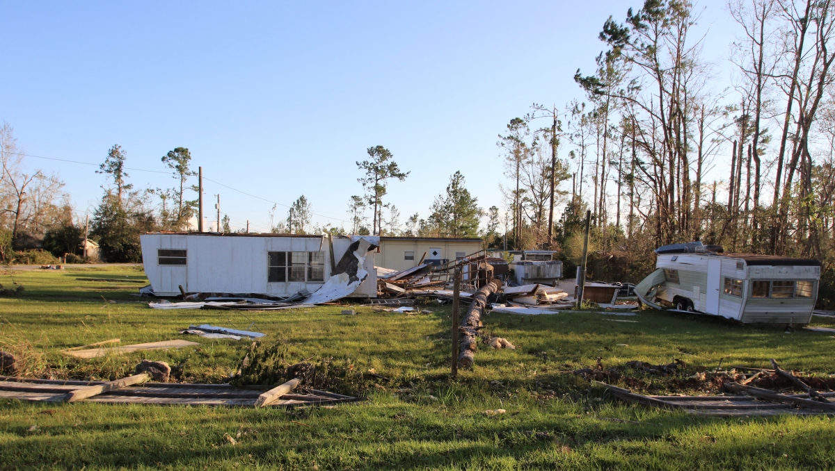
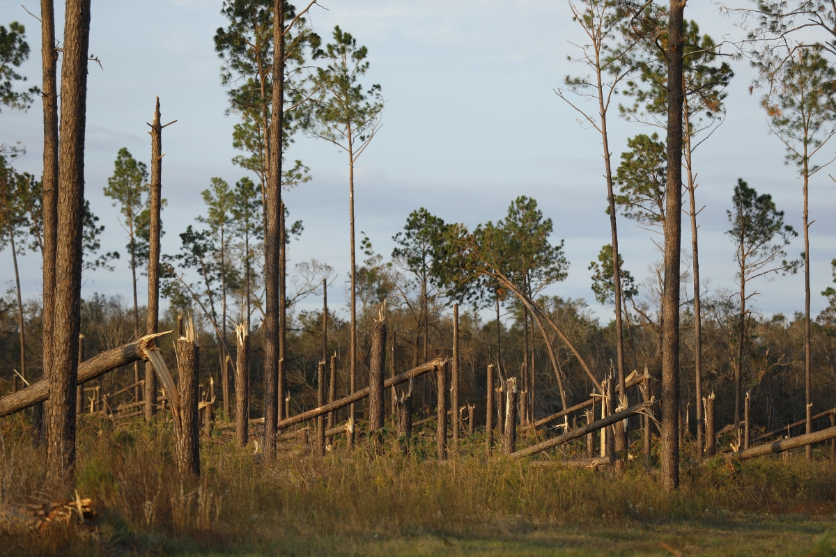
The Panhandle needed all the help it could get in 2018 after Hurricane Michael barreled through with killer, 160 mph winds. Mexico Beach was almost wiped off the map. Other towns along Michael’s path were pummeled, too. Countless fields and forests in-between suffered major damage.
The U.S. Fish and Wildlife Service in the Southeast is helping those communities revive, providing the mapping and technical support to identify places within the Florida Panhandle that are critical to the region’s ecological health. Communities from Quincy to Mexico Beach are connecting biodiverse landscapes, creating recreational opportunities, and celebrating cultural resources while building more resilient economies.
And they’re using the Blueprint, a continuously updated mapping tool, to get the job done. It’s also being deployed by the U.S. Forest Service to prioritize land acquisition in South Carolina; by the Defense Department to identify conservation opportunities in northwest Florida; by NGOs to protect Atlantic salt marshes; and by communities in need of more equitable access to greenspace.
Each Blueprint-fueled project dovetails nicely with the Southeast region’s vision of “working with and for people.” Conservation only works when public and private groups band together for the benefit of wildlife, plants and people.
The mapping tool hews closely to the conservation priorities of the region’s 15 state natural resource agencies, as well as those of Puerto Rico and the U.S. Virgin Islands. The Service’s mission, after all, is to protect and recover threatened and endangered species, as well as to preserve wildlife habitats at 130 refuges across the region.
The Blueprint is the data-fueled engine of the Southeast Conservation Adaptation Strategy, a regional initiative working to connect lands and waters to benefit wildlife and surrounding communities. State and federal agencies, as well as NGOs, tribes, universities and private entities, rely upon the Blueprint to boost, by at least 10 percent, “the health, function, and connectivity of Southeastern ecosystems by 2060.” They also use it to make the case for new funding opportunities.
The mapping tool proved a technological lifeline for battered Panhandle communities. Virtually every building in Parker, just east of Panama City Beach, for example, was damaged. The Florida Caverns State Park, near Marianna, lost more than 80 percent of its trees. The winds destroyed most of a nearby farmer’s 3,800-acre loblolly pine crop.

Fearing more hurricanes, the towns decided to re-imagine their economic, cultural, and environmental futures. Region-wide cooperation, they decided, was the key to a resilient 21st century. The Federal Emergency Management Agency brought experts and money together to help the Panhandle towns lay out their visions for downtown development, stormwater management, recreational opportunities, and trail networks to connect parks, greenspaces, rivers, lakes and cities.
The Blueprint also helps local groups, like the North Star Legacy Communities, identify places where African American history, culture, and natural resources all come together to boost tourism and economic development. North Star, founded by Dr. Sandra Thompson, uses the mapping tool to plan a cultural heritage trail in northwest Florida. The Blueprint, she says, “builds capacity for vulnerable rural communities to achieve community and economic vibrancy.”
The Service’s work in the Panhandle also highlights the agency’s commitment to community-led conservation efforts, climate resilience, wildlife corridors, and America the Beautiful.
Perhaps no state uses the Blueprint as much, or as effectively, as South Carolina. Federal, state, regional, and municipal governments, as well as NGOs and universities across the Palmetto State, employ the mapping tool to make sound conservation decisions. The U.S. Forest Service, for example, uses the datasets to acquire the most compatible pieces of property in the Francis Marion and Sumter national forests. In Sumter, the Blueprint helps make a compelling case for land protection in the oft-overlooked Piedmont region. And it assisted the forests in strengthening grant proposals for Land and Water Conservation Fund dollars. More than $16 million has been awarded to acquire and protect 12,000 acres of forested land in South Carolina.
At the state level, the Blueprint provides the technical heft that helps update federally mandated wildlife and forest plans. The S.C. Department of Natural Resources also uses the spatial analysis tool to undergird requests for wetland and forestry grants.
At the local level, the Catawba Council of Governments employs the Blueprint to help towns like Fort Mill and Van Wyck recommend conservation actions and identify natural resource priorities, including restoration of Piedmont prairies and riparian buffers. Local officials then decide what gets conserved and where.
“The Blueprint’s maps and analyses provide additional validity to the importance of our projects, makes them more competitive nationally, and helps secure funding for increased federal land protections,” says Peggy Jo Nadler, a Forest Service lands program manager in South Carolina.
The Blueprint’s possibilities are boundless. Yet it’s just one, albeit powerful, tool used in the Southeast to bring people together with the land that they love.