Southern Appalachian Blueprint User Support Team hits the ground running
In 2020, the Southeast Conservation Adaptation Strategy added five new Southeast Blueprint staff throughout the region. Three of those team members–Emily Granstaff, Daniel Adams, and Chris DeVore–were placed in Cookeville, TN to be co-located with the U.S. Fish and Wildlife Service Tennessee Ecological Services Field Office. The new Cookeville team was put in place to improve Southeast Blueprint user support and GIS capacity in areas of the Southeast with plenty of opportunity to meet SECAS goals and priorities. The team’s primary focus areas in 2020 were the Southern Appalachians (KY, TN) and Middle Southeast (MS, AL) geographies.
Despite the atypical work environment of the last year, the Southern Appalachian team hit the ground running and formed valuable relationships in the region to support several projects. The team’s goal for this first year was to start by complementing existing efforts in the region or helping guide new efforts in need of landscape-scale direction. Here are a couple examples of projects the team helped with:
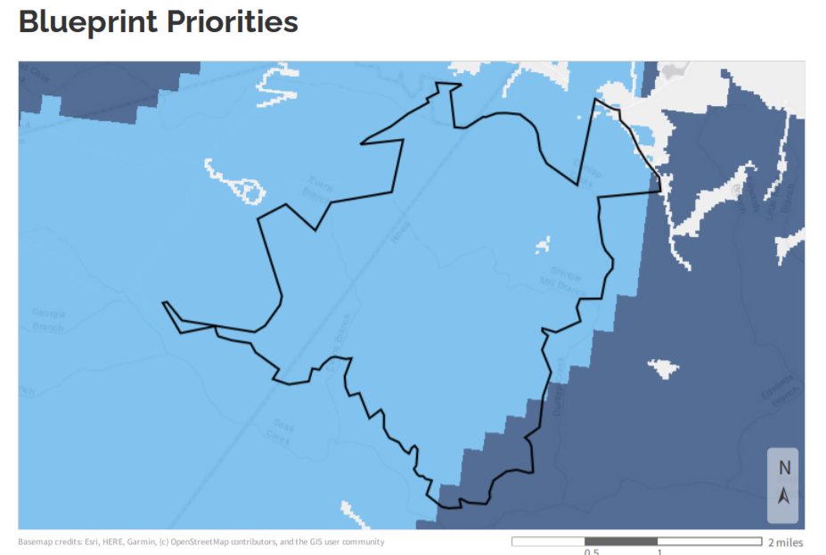
- TennGreen Land Conservancy (TN): The Cookeville team recently supported a TennGreen proposal under the National Fish and Wildlife Foundation’s Cumberland Plateau Stewardship Fund. The proposal requested funds for aquatic habitat restoration and prescribed burns on a newly acquired 2,000 acre parcel of land in the plateau. The Blueprint team found the parcel served as a keystone in a regional climate corridor found on the plateau, and 99% of the parcel was recognized by the Blueprint for its unique geographic location and features. Restoration work on the protected parcel will greatly benefit the larger connected network of lands and waters that SECAS is working to achieve, and our team provided supporting documentation to bolster the application.
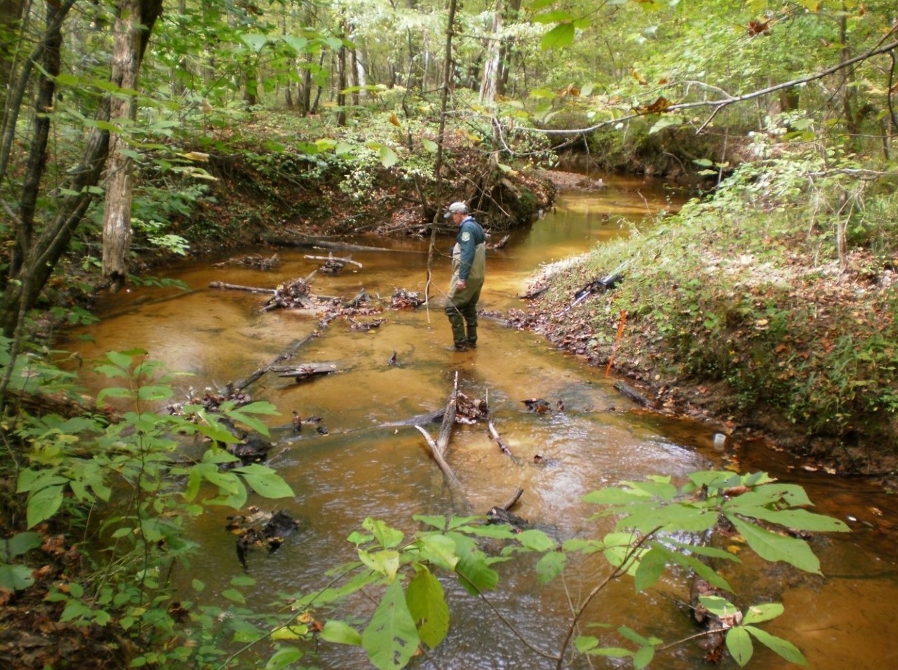
- Joint Chiefs’ Landscape Restoration Partnership (TN, NC): A coalition of partners led by the U.S. Forest Service and National Resource Conservation Service submitted a large-scale project for USDA Joint Chiefs’ program funding over the next three years (2021-2023). The project called for aquatic habitat assessments and restoration of over 34 high priority catchments in and around Cherokee National Forest. This project was funded at just over $5 million over three years to restore and maintain pristine aquatic habitat for the benefit of at-risk species in the region. Our Southeast Blueprint user support team helped support the effort by providing a landscape analysis for the project, as well as species information to help guide the restoration efforts.
- Mississippi Aquatic Network (MS): The Cookeville team recently engaged with other FWS programs with the goal of creating an aquatic network for a larger cohort of external partners. The Mississippi Ecological Services Field Office contacted our user support team in hopes they could help identify aquatic priority areas in the state based on habitat conditions, species data, restoration potential, and more. The goal of this effort is to create shared aquatic focal areas in the state which can help direct conservation efforts not just within FWS, but with state and NGO partners in the area as well. Efforts are underway with the Field Office and the Mississippi Museum of Natural Sciences to set the parameters for this model. The efforts will evolve as more stakeholders are invited to engage, because it is the ultimate goal to build a larger network of partners (MS Aquatic Network) to support the newly identified MS aquatic priority areas and create a connected aquatic network throughout the state.
These are just a couple examples of introductory Blueprint use cases over the last year. With over 100 Blueprint use cases already completed, and 50 more in progress, we can see the collective impact on the landscape of coordinated conservation. By increasing conservation actions within the Blueprint, use cases like these bring the entire conservation community closer to achieving the SECAS goal. We are excited to see progress underway in our newly supported geography, and we encourage you to reach out to your local user support contact to see how they can serve as a free resource to support your upcoming endeavors!